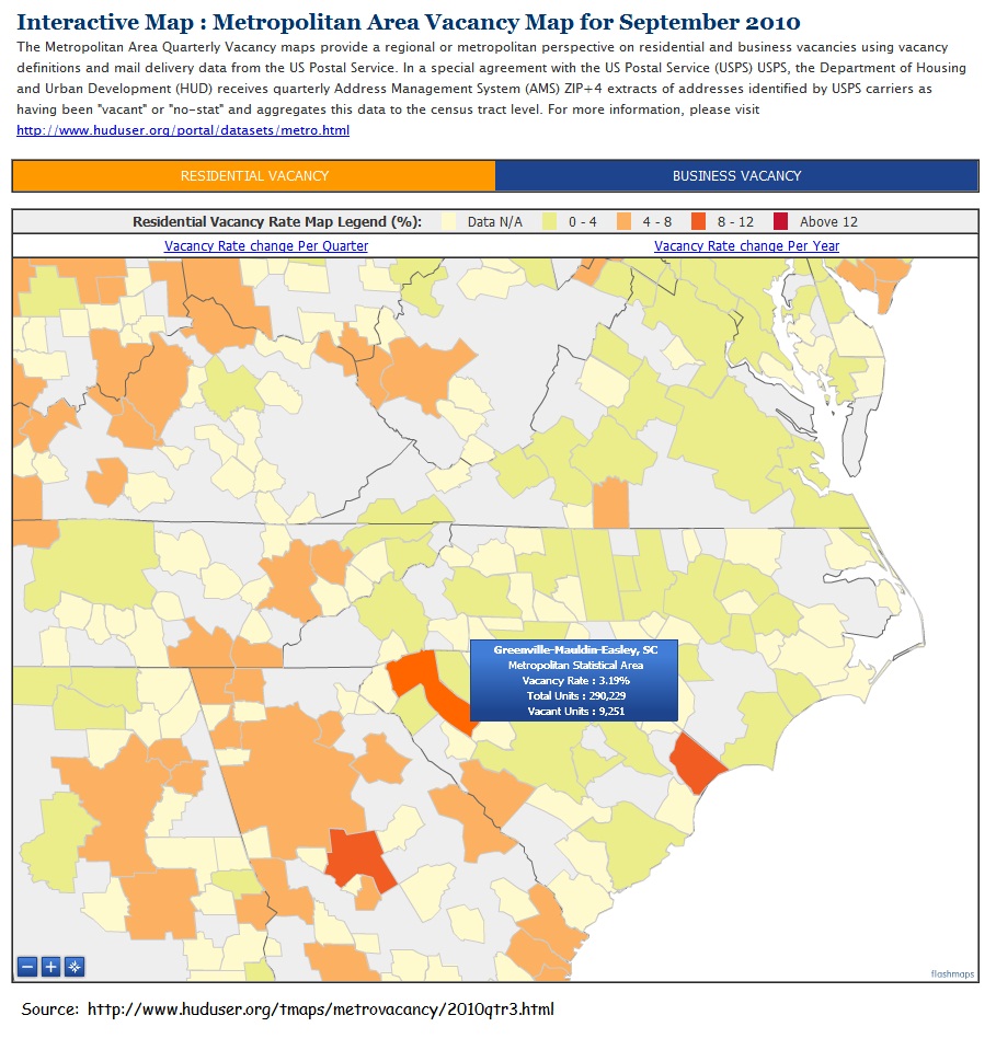
Comprehension
questions for above image:
1. Who
would find the information on this map useful?
a. Post
office workers
b. Census
takers
c. Teachers
d. Scientists
2. Although several states are shown on the map,
what state and city are the focal point?
a. Charlotte,
NC
b. Columbia,
SC
c. Greenville,
SC
d. Durham,
NC
3. According to the information provided, how
many vacant units were in this area in 2010?
a. 290,383
b. 3,190
c. 9,251
d. 90,251
4. The dark orange shaded area stands for what
numerical value?
a. 0-4
b. 4-8
c. 8-12
d. Above
12
5. What organization published this map?
a. USPS
b. HUD
c. USAID
d. SC
1.
Who would find the information on this map useful?
a.
Post office workers
b. Census takers
c.
Teachers
d.
Scientists
2.
Although several
states are shown on the map, what state and city are the focal point?
a.
Charlotte, NC
b.
Columbia, SC
c. Greenville, SC
d.
Durham, NC
3.
According to the
information provided, how many vacant units were in this area in 2010?
a.
290,383
b.
3,190
c. 9,251
d.
90,251
4.
The dark orange
shaded area stands for what numerical value?
a.
0-4
b.
4-8
c. 8-12
d.
Above 12
5.
What organization
published this map?
a.
USPS
b. HUD
c.
USAID
d.
SC